Showing posts with label travel peru. Show all posts

Tuesday, September 13, 2011

Do Nazca Lines Extend to North America?


Along with mysterious lines present in the arid area of Nazca in Peru we can also observe comparable lines drawn many years ago in California near the town of Blythe. The Fort Yuma Indian Reservation on the lower Colorado River is near this town and the drawings therefore bear the name Blythe Intaglios.

On another part of the world you may see similar mysterious drawings in a neighborhood of Nazca, a small town at the mouth of the river that goes into the Pacific Ocean. The city is some 400 km south of Lima in Peru. It lies near the system of valleys and plateaus on the southern coast of Peru, where these famous drawings can be seen. Nazca is also the name used for the Nazca culture that flourished in the area some time around and after the year 300 BC.

The lines - both in Nazca and Blythe - only give complete images if we see them from above (from an airplane). Unlike in Peru, where we can no longer meet indigenous people directly associated with the drawings, the original inhabitants (Indians) still live on the lower Colorado River near Blythe. Quetsan or Quechan, sometimes Yuma, Yuman, Kwtsan, Kwtsaan, is the name for the Indians that live here. The word Yuma comes from an old name used for a group of Native American ethnic groups.

The Yuma people, who today prefer to be called rather the Quechan, have long been known as very good fighters.

Apart from the very well known Dänikin-type hypotheses that imagine aliens everywhere in ancient archeology if it is possible, we can explain the purpose of the Nazca and Blythe lines simply:

1 The patterns correspond to constellations of the stars.

2 The purpose of their creation was of a ceremonial (ritual) character.

3 The lines secretly point to some underground places.

Ancient aqueducts are really present in the Nazca region and together with these very old sky drawings they are, too, some 2000 years old.

Even today, these ancient aqueducts (underground water tunnels) are used for irrigation in the Nazca region and they belong to the group of a few unparalleled construction works of the South American Indians.

The underground water tunnels are accessible even today. It is therefore quite probable that these lines may contain encrypted information on how to find some underground spaces. We can go perhaps even further and think of these theoretical underground locations as something that has a connection to ancient secrets, or even pathways to the Aghartha.

Lore Cachora, the Quetsan elder, says that the drawings were used for rituals and as these patterns produce a complete picture only from above, religious ceremonies took place on them. The Indians used them for the same purpose as we use our churches today. Lore Cachora further says that figures of the drawings represent deities of the Creation. One such a deity is Mastamho - the grandson of Mother Earth (Pachamama) and the Heavenly Father.

David Whitley, one of the leading experts on ancient drawings, confirms this, too. In his opinion, the ceremonial significance of the Blythe intaglios could have the same spirit as the ancient creators of the Nazca lines possessed, but unfortunately, we cannot say this for sure. The Blythe intaglios definitely picture the Creation, but as far as the Nazca lines in Peru are concerned, we do not have enough arguments to say the same thing.

The Astronaut - Nazca Lines

Monday, August 8, 2011

Arequipa Peru's Second Most Important City

Peru is one of the most popular South American vacation destinations. There is rare wildlife, the remains ancient cultures, unique artifacts, alpaca clothing, exotic food, lively music, amazing jewelry and artwork and lots of adventure. Visitors to this Latin American nation create memories they will cherish forever. Many of those vacationers will experience the sights of world renowned cities like Lima, Peru's capital and Peru's second most popular city Arequipa. Travelers to these cities often feel like they have found themselves in a different world. There are so many things they can experience in Peru that are available nowhere else in the world.

Peru Arequipa


When most people mention Peru they usually quickly follow up with conversations about the capital, the party city of Lima. But the city of Arequipa is also very special. This southern Peru city has a lot to recommend it. Arequipa is Peru's second most populous city with almost a million inhabitants. The city is popular for many reasons. One of the things that draws people to Arequipa is the climate. Although its located on the edge of a desert, the fact that it is over 2,300 meters above sea level mitigates the heat and leaves Arequipa with a very mild climate. Scenery is another reason people love visiting Arequipa. There are vast plains, stunning mountains and over 80 volcanoes nearby in the Valley of Volcanoes. The best known of these are El Misti, Chachani and Pichu Pichu. Some believe the name Arequipa may be an Arymaya word meaning 'behind the peak' referring to El Misti.
Arequipa has some of the most beautiful examples of Spanish colonial architecture. The buildings were made out of off white volcanic rock. They represent a masterpiece of European Columbus-era building style. These pearl-colored buildings utilized the local materials but molded them into the classic Spanish style. The stunningly beautiful structures have led many to give Arequipa the nickname 'The White City.'
There is lots to do in Arequipa. They can visit the Santa Catalina Monastery, San Francisco Church, La Recoleta Convent and San Agustin Church. There are also numerous festivals, bullfighting and a variety of sports. The food in Arequipa makes visiting the local restaurants a gastronomical pleasure. The dishes made with beef, alpaca, guinea pig, fish, ostrich, shrimp and a wide variety of vegetables combined with chili peppers and other local spices are cooked in Chinese, Japanese, European and indigenous styles.


Peru Arequipa
El Misti and Arequipa
View from rooftop of Arequipo monastery
Arequipa vista
Countryside of Arequipa
El Misti
Colonial cathedral outside Arequipa
Corridor of Santa Catalina Monastery


Peru Arequipa
Vacaciones en Arequipa
La aventura en Arequipa

Peru Travel Lake Titicaca Tours Ideas

Lake Titicaca is the highest navigable lake in the world, and is the largest lake in South America. It is home to the Bolivian Navy (being the only accessible part of water for the land locked country) and a range of ancient cultures that live on today.
What attract so many people to the lake is the lakes inhabitants that live on manmade reed islands in a process that has existed for generations. While many of these islanders have now moved towards a tourist dependent income, some of the islands are remote and away from the tourist boats that visit – preserving their society and culture.
The Lake is the dividing between Peru and Bolivia, and sits between the route from Cusco to La Paz making the lake a transit hub and welcome break on the long journey. There are direct buses and trains from Puno to Cusco as well as Copacabana to La Paz. Puno also has its own airport with flights in and out of Lima.
The lake is made up of a number of islands that are split between Bolivia and Peru, with them being visit able from the main towns in each nation, Copacabana and Puno respectively. These towns are where the majority of tours leave from.

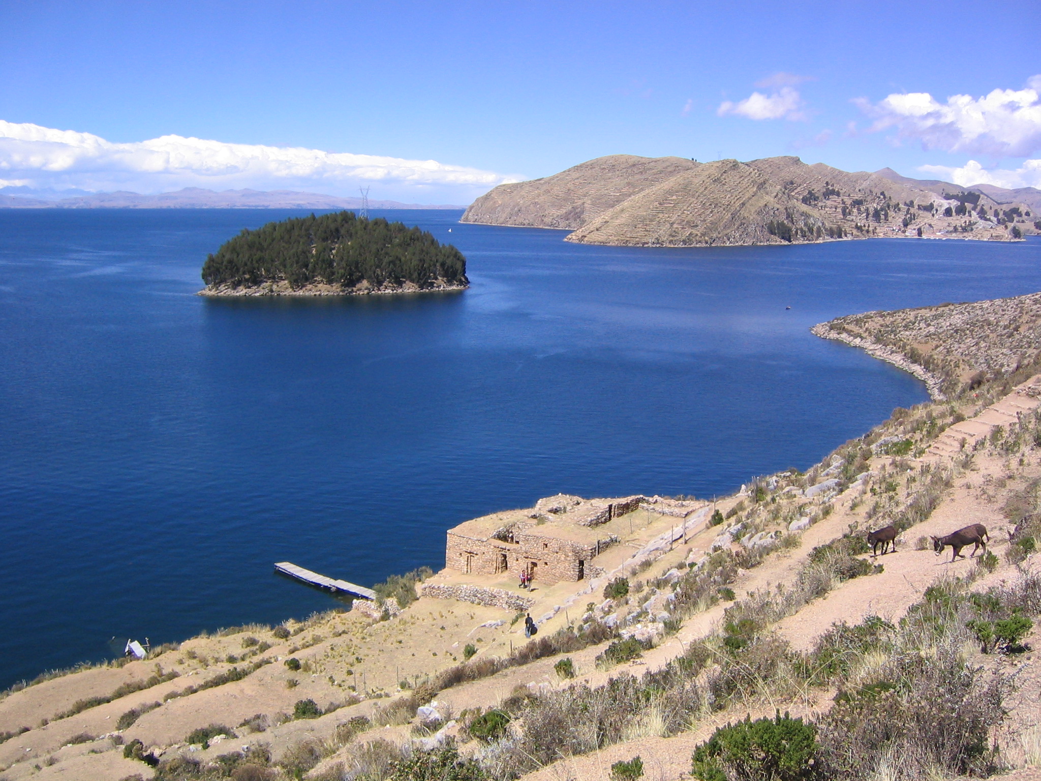
Rikcha:Isla Chelleca Estrecho de Yampupata y Lago Titicaca La Paz Bolivia.jpg


Day tours will take you to a number of the famous Uros islands where to can see how the ancient cultures still live today. The islands themselves are an attraction, being constructed by a number of totora reeds that grow in abundance at the side of the lake. The islands require constant maintenance to and this process has been passed down over generations. Some of the islands are open for tourist visitors, whose income is dependent on tourism when other are in relative isolation.
One of the most interesting islands is the Island of Amantani. This island is home to a number of home stays and lodges for visitors to the islands. These offer a unique insight into a different culture and society that lives on today that is very different to our own. Be prepared though, as the accommodation is basic, yet the homes are warm and welcoming with some tasty home cooked local food.
After a day of touring the Islands of Uros you may be interested in visiting the small Island of Taquile which is located about 45 km from Puno and is abundant with numerous pre-Inca and Inca ruins.
The whole lake area is scattered with a collection of Inca and pre-Inca ruins and temples. One of the biggest sites is the former town of Tiahuanaco, on the Bolivian side of the Border. Interestingly according to Inca myth the Inca creator (Who is also the sun) emerged from the Lake to create the Incan dynasty. Tiahuanaco is accessible as a day tour from Puno, Copacabana as well as La Paz.
The town of Copacabana is the gateway to the Islands of the Sun and The Moon, with cheap public ferries operating the route along with guided tour boats. These islands are also home to a number of temples and ruins which are wonderful to see.
If you time your trip to these islands correctly you can see a fantastic sunset over the lake.


Islas Flotantes, Lago Titicaca

Peru Travel: Lake Titicaca
The reed islands and boats of Lake Titicaca.


Taquile
Puno Cathedral
Town of Copacabana, Bolivia

Sunday, April 17, 2011

Inca city , Machu Picchu

One of the most visited sites in the world today by travelers is Machu Picchu. It is located in Cuzco, Peru in the high Andes Mountains. It is approximately 724 miles away from Lima, the Peruvian capital. A typical trip by land on a bus takes about 20 hours. One could also take a flight and arrive there in a heartbeat of one hour. The starting point usually begins in Lima.

The ruins sit surrounded by the Andes Mountains at about 11,024 feet above sea level. The name Machu Picchu literally means “old peak”, translated from the Quechua language. It was discovered by Hiram Bingham on July 24, 1911 while he was in charge of a Yale University expedition. It was in this landscape that the Incas built Machu Picchu at the end of the fourteenth century.

The climate is mild, warm and damp. It has a year round average temperature of 55F during the day. There are typically two seasons, a rainy season which lasts from November to March and dry season, which lasts from April to October. Most travelers prefer to travel to the site during the dry season.

Personal Travel Experience

I had the pleasure of visiting Machu Picchu 22 years ago around this time when I was a small child. I was accompanied by my mother. The scenery was beautiful and breathtaking. We took a train from the city of Cuzco and it took us just a few hours to get to Machu Picchu. Then we had to take a small bus up the trail all the way to the top. Nowadays, there are two ways to connect from Cuzco. One is a Tourist Train, which only operates in the high season. The trip takes four hours and returns in the evening. Then there is also the Autovagon, a tourist service that takes three hours to get to the site with an evening return trip as well. Both leave in the early morning hours.

We highly recommend you to put Machu Picchu, Peru as one of your top travel destinations to visit in the near future. The experience will be unforgettable.

UPDATE: On July 7th in Lisbon, Portugal, Machu Picchu was voted in as one of the new Seven Wonders of the World.


Popular Posts